sreda, 23. oktober 2013

Day 4 - Marathon and adventure

Thursday, 12th of September 2013
 
The grand plan went on. We started the day by dividing into two groups, the first one containing the fast and enduring, while the second group consisted of the precise and well-equipped. The first group’s task of the day included 40 kilometres of cycling and 820 metres of altitude difference. Note that in all the previous days combined, we cycled for 80 kilometres and beat 800 metres of altitude. Brave people.


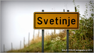
The second group walked to Svetinje, proliferated with maps, cameras and coloured markers. They mapped out areas in need of reparation or with a potential to support new infrastructure for hikers and bikers.


The Marathoners
The Marathoners (alias 3 Shades of Blue, due to our matching outfits) launched out at 9’o clock and headed towards Ljutomer via Gresovščak and those lovely fishing ponds mentioned before in the blog. Oh, remember the third area of interest, mentioned in our first blog post? The one about wider areas meant for (semi) professionals? We were covering that part today. We drove through Slamnjak, Ilovci, Hermanci and then rushed downhill to Miklavž pri Ormožu. 


The route continued along the valley and the main road between Miklavž and Ormož. Next we turned towards Hum pri Ormožu. While pedalling uphill we noticed a marked hiking route, which led us to the church atop Hum. Local Rumour has it, that there is a hiker’s stamp hidden somewhere around the now defunct school building.  Hum had a kind of mysterious charm to it. We suspect that has something to do with the locals, who kindly offered us figs and the best wine in Slovenia (according to a competition by the newspaper Delo). All shades of blue unanimously agreed that Hum deserves a place on the longer route.

After the Hum experience we headed towards Ormož. Disregarding the road maintenance services in Pušenci, we turned from the main road and found a separate cycling track, which brought us to Ormož safely. From there, we drove on a tranquil road through Dobrava, Limerk and Stanovno. 


As we reached the top of the ridge, we had our breath taken by the far-reaching view. Remembering to breathe again, we darted downhill to Ivanjkovci, crossed the main road and pedalled towards Veličane. The sky cleared at last and light swept through the valleys. The planned visit to Cerovedc Stanka Vraza had to be cancelled, as the hospitable Hum took too much time. Instead we headed uphill towards Taverna (the stylish tavern you should visit when around). There we took a few moments to rest and enjoy our first dose of sunlight in days. Twenty minutes later we arrived at Vinski Hram Jeruzalem and met up with the second group.


The Designers
The second groups, dubbed the designers, took a walk to Svetinje. Though exploring a familiar route, there was more than enough motivation to find new solutions. The first major thing that caught our attention was the layer of gravel on a steep downward slope road, right before a sharp turn. A storm two days before ravaged the gravel embankments and the road was turned into a killing ground for the unwary. When we later headed back past the same spot, the gravel was removed from the road, but put back into the embankment. It’ll stay there until the next storm.


We also inspected the area for spots and stripes suitable for new infrastructure. We figured there are two basic ways to provide security for bikers. The narrow roads could either be extended, giving more space for both cars and bikes, or separate parallel tracks could be made, to keep cyclists out of car’s way. We found the idea of separated tracks quite appealing, since it would be possible to direct the tracks trough parts of the vineyards, opening up many unique viewpoints, otherwise unavailable from the current main road.
Our third task was to mark potential rest areas. This task was quite difficult, since the entire area is scenic enough to serve as a rest area, but we managed. 


All suggestions were drawn into a map and photos of interesting places were taken. After the reconnaissance we met up with the Marathoners in Jeruzalem.

Hectic afternoon
As usually, we exchanged impressions and terrain intelligence. The sun was shining outside, but unfortunately we couldn’t bask in it much. It was once again time to review, edit, rephrase and analyse all the data and experiences we gathered in the past few days. Expect our results shortly and make sure you tune in later for more reports. 


Day 3 - International, Interregional, Multicultural

Wednesday, 11th of September 2013

Morning
We woke up slightly and talked out the plan for the day at breakfast. We were given a lot of freedom in scheduling our work. Originally we intended to try out the Austrian-Slovenian cycling route network between Bad Radkersburg and Mureck, but decided to cancel it because of the gloomy weather. Then came Wednesday and along with it better weather than we expected. So Austria was rescheduled for the Wednesday afternoon. 


After a plentiful breakfast we headed towards Pavlovski Vrh again, this time cleverer and faster than the days before, and took more precise photos of the roads, analysed the terrain’s options and also tried to find an alternative route, which would avoid the narrow main road through Pavlovski Vrh (albeit unsuccessful). We also set up an ambush, by placing the bikes on the edge of the road, waiting for cars to pass by. The results were following: 

1.       We have confirmed that the traffic through Pavlovski Vrh is very scarce.
2.       We now have a photo demonstrating the effective width of the road.
3.       A female driver was very confused. 


Before the return to Jeruzalem we split up into two groups. The adventurists headed down an unknown road with a large altitude difference, while the romantics headed back by following a scenic ridge. The adventurists returned 5 minutes earlier and were consequently victorious. Both teams still had time before lunch and dedicated it to data analysis, photo selection and of course to creating and translating blog content for you guys.


Afternoon
At lunch we were joined by our co-workers from PRA (remember that development agency we mentioned at the start of our blog?). We greeted them, shared our findings and suggestions before boasting with our mileage.  Afterwards we met with Paul Watkinson, an expat from the UK and founder of Simply Cycling Slovenia. With his help we managed to transport our 7 bikes to Austria. 


And so our little espionage mission began. We were on the lookout for transferrable successful practices. Talking to Paul was also insightful. According to his opinion, Slovenians often shy away from thinking big. He also suggested linking the routes around Jeruzalem with the Mura-Drava project to expand opportunities for tourism. At first it seemed that the weather would undermine the excursion, but later the rainy clouds retreated. Austria did offer an unexpected lesson, namely that just marking the routes in a comprehensible manner goes a very long way. 


Surely, Austrian car drivers are also way more patient, but many other things are within the reach of improvement. Racing against the clock, we didn’t drive all the way to Mureck, but crossed Mura and the border at Apače and closed the circle by returning to Gornja Radgona and Bad Radkersburg (the same town split by the Austrian-Slovenian border). The difference witnessed between the Slovenian and Austrian side is stunning. It’s like two different worlds existing within less than a kilometre of distance. Most of the routes ran along the main roads, unaccompanied by cycling tracks at least half of the time. We managed to get to the coach just before the rain resumed. 


Dinner became more of a meeting. We met with Goran (the PRA director) and exchanged opinions and findings, especially on existing success cases and the possibility of imitating them in our region. We finished right on time, just before the restaurant was about to close.

Day 2 - Transprlekija ~ Passing Siberia

Tuesday, 10.9.2013

Firstly
In the morning we waited for the last bike to arrive – and a good thing we did, because we the waited long enough that the sun came out. It was early and we were enthusiastic and full of energy, so we decided to head to Ormož first. We haven’t managed to engage any collaborators from that area, so we felt like foreigners invading a forbidden homeland. We took the same route as the day before; with a difference that instead of the pouring rain, sunshine was pleasantly sharing it’s warmth with us.


We reached Svetinje with no trouble and long stops, only because we were avoiding the inviting looks of Zidanica Malek and Taverna. Of course we couldn’t ride the whole way without one minute breaks for photographing, especially because the weather was in our favour.


We continued our way from Svetinje to Ormož on the route that has been suggested by municipality Ormož as attractive. The picturesque road led us along the ridge to Pavlovski vrh, from where we swooped down the slope to the main road, which connects Ljutomer and Ormož trough the valley. We consider the route attractive, scenic and not too challenging.
But the junction with the main road is a biker’s nightmare. Local drivers are too fast, since they’re familiar with the main road, and the road has neither safety signalisation nor separate cycling paths.


This changed for a brief time, on a cycling track just outside Ormož, but the track didn’t reach past the next crossroads. The track could have continued, as there was grass-covered space next to both sides of the road. To all locals in power: if you want to attract cyclists and hikers to that area, a separate path is necessary. There’s plenty of space.


Displeased by the main road, more suitable for preforming stunts over passing trucks, we decided to take a different route from Ormož back to Jeruzalem. We headed from the centre of Ormož towards Dobravska ulica, which (shockingly) led us to Dobrava and after a steep ascent to Litmerk. 307 meters above sea level, Litmerk offers great oversight over the surroundings. 300 meters is more than enough. If you distrust us, check the pictures. Especially towards the northeast, one can observe Jeruzalem and other hills and the sparkling surface of the lake in Ormož.

We descended from Litmerk, crossed the main road (THAT very same aforementioned road) and closed the circle by heading back towards Pavlovnski Vrh via Libanja. Before the treacherous upward slope in Libanja, stood a small chapel with the inscription: “Holy Trinity, have mercy for us.” We overlooked this sign and were late for lunch.

Secondly
We returned full of impressions and pleasantly tired. The Libanja ascent gave us plenty of time to reflect upon our experiences, and many suggestions and observations fully sprang up during lunch. Then we uploaded our photos to computers and wrote parts of this blog entry. There wouldn’t be time for that in the afternoon. That time was reserved for a visit to Ljutomer.


We chose the route used by hikers on several traditional yearly hikes to Jeruzalem. We descended past the Belec homestead and dashed into Radomerje. We didn’t have time for the food from the guesthouse Stari Hrast or to visit the nearby birth house of Franc Miklošič, the Slovene cultural giant. We could have also taken the alternative route, leading trough Cuber, where there’s a museum of agricultural tools and inventions.

The next checkpoint was at Spodnji Kamenščak, featuring a quite steep uphill slope. But then we remembered Libanja and things suddenly became easier.  Passing past a mechanic’s workshop, we joined the main road but soon diverged from it, turning toward Villa Magdič for a brief time before heading towards a forest pathway for some off-road downhill adventure. Still feeling the adrenaline rush, we drove past the primary school in Ljutomer, trough Stari trg (the Old Town Square) and to our destination, the Tourist Information Centre (TIC) on the Glavni Trg (Main Square) in Ljutomer. We tested the relatively new biking trails in Ormoška Cesta and headed back towards Jerusalem. This time, we took a route past a series of fishponds and trough the forests towards Gresovščak. The road continued uphill at Železne Dveri and we eventually jointed the Jeruzalem Wine Route, rendering the return to Vinski Hram a piece of cake.

The evening was reserved for data analysis. We fed in the data, checked the mileage, height profile, the average and maximum travel speed and more other small bits of data generated by our pretty electronic devices. Still remembering the trauma from Libanje, we unanimously decided to mark difficult or dangerous parts of the terrain.

We cycled for 41 kilometres and beat 890 metres of altitude. We were proud of this feat, especially because some of us don’t bike on a weekly basis. We hope to find more paths tomorrow and are inviting you to tune in again.

torek, 22. oktober 2013

Day 1 - A Walk in the Rain

A Walk in the Rain
monday, 9th of September

Prologue
We woke up to a rainy morning. Menacing storm clouds, rolling in from the west, were persistently approaching us and seemed like a bad omen. We disassembled the bikes, loaded them into cars and headed towards Jeruzalem in Slovenske Gorice. That took a while due to unpredictable weather and road conditions and our drowsy sense of orientation. Full attendance was achieved during our first meeting. The project didn’t only attract enthusiastic cyclists and hikers but also professionals from many fields, for example geodesy, geography and photography. This diversity has shown to be essential for successful cooperation.


One
Prleška razvojna agencija (the Development Agency of Prlekija, hereinafter named PRA) in cooperation with the municipalities of Ljutomer and Ormož are implementing the project KOLESARSKE IN SPREHAJALNE POTI V KRAJINSKEM PARKU JERUZALEM (Cycling and walking routes in the landscape park Jeruzalem). The project is supported by the EU LEADER program. A part of the aforementioned project is also a research camp, taking place from the 9th to 13th of September. Preceding the camp there were workshops with the aim of generating suggestions and expectations by conversing with local residents, service providers and amateur athletes.
Despite a few participants missing due to the weather conditions, we started the introductory meeting according to schedule. The director of PRA, Goran Šoster explained us the main goals of the project and the research camp and presented the findings of previous workshops, the results of which were often self-contradictive. These goals included reviewing existing cycling and walking routes and finding new ones, evaluating their difficulty and duration and finding sensible and scenic points for rest. Naturally, we were expected to contribute fresh ideas and plans on constructing new infrastructure or restoring existing objects, to make the region friendlier towards cyclists and hikers. 


Our area of interest can be roughly divided into three parts.
1.       Svetinje-Jeruzalem, meant to be intensely developed in the near future to suit hiking and biking needs.
2.       Ljutomer-Jeruzalem-Ormož, to establish a backbone connection between Ljutomer aand Ormož via Jeruzalem.
3.       Wider surrounding areas, which would be used for more intense or longer routes, more suitable for professional or semi-professional bikers and hikers.
More intricate details on the focus areas will be available in the publication at the end of the camp, but for now let’s just say we’re expected to be innovative, watchful and bold.


Two
Despite the project’s name containing the word “camp” we settled into rooms in the hotel Vinski Hram Jeruzalem. After a splendid lunch we headed down the Vinska pot (Wine Route) towards Svetinje, armed with maps, photo cameras, GPS devices and rain jackets. We were on the lookout for existing markings leading down the Jeruzalem Wine Route and pathways suitable for biking and hiking. We also considered whether some existing roads could be used according to the “shared space” principle. Since the roads are narrow, we agreed on the necessity of a separate route for bikes, either on a sidewalk or divided from the road by a green belt. In addition to the roads being narrow, they offer a limited vision of the way ahead and the asphalt is worn and cracked. In the worst case, the roads may pose a danger to bikers and pedestrians. It needs to be renovated and broadened. 


While exploring the routes, it’s impossible to miss many locations very suitable for resting or sightseeing. We also warn interested visitors of the food and wine providers. Their cuisine tends to be irresistible. We arrived to Svetinje, soaked but in a good mood. We were silently greeted by the old Črna pot (Black path) and by the now crumbling school, which also served as an apartment, recording studio and an art atelier in its better days. 

To return back to Jeruzalem, we explored a road, which lead us to a steep slope downwards, a cemetery and finally to a valley, where it converged with the existing Wine Route. As rain intensified, we walked past a herd of sheep, many rural homes and cottages, all surrounded by vineyard terraces. We returned to Vinski Hram. 


Three
The plentiful dinner prepared us for a session in the conference room. It was just a spacious room, with enough chairs to keep us all seated and enough electricity sockets to keep all of our laptops running. But it felt better to give it a more professional name. Anyway, we summarized our results and impressions of the viewed tracks, debated options for improvement and sought other successful examples. We sorted through about 200 pictures, selected the best ones. All for you people out there reading this blog. We swear.

Epilogue
The blog started as a joke, but stuck around during the course of the day. Thanks for keeping step with us and remember to check our other blog entries, if interested.